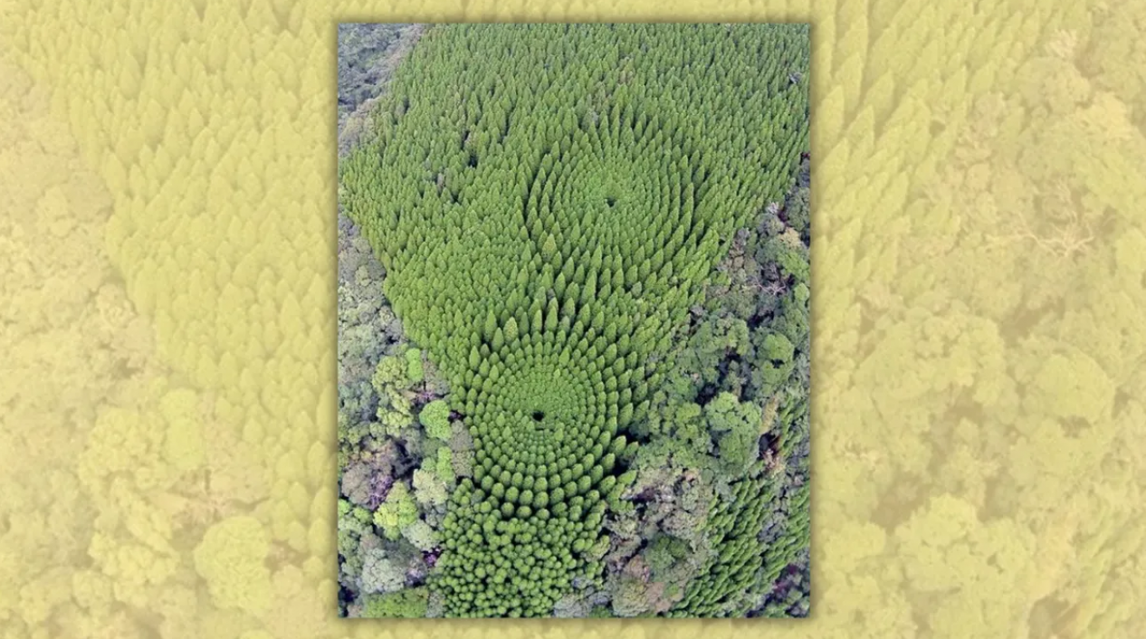
The trees were deliberately arranged in circles to test the effects of different planting densities.

In September 2026, an aerial photograph of trees growing in concentric circles spread online, with social media users claiming they were part of a decades-old forestry experiment in Japan.
"In 1973 Japan planted trees in concentric circles as part of an experiment in forestry spacing. This is what they look like today from above," one Reddit post (archived) captioned the photograph.
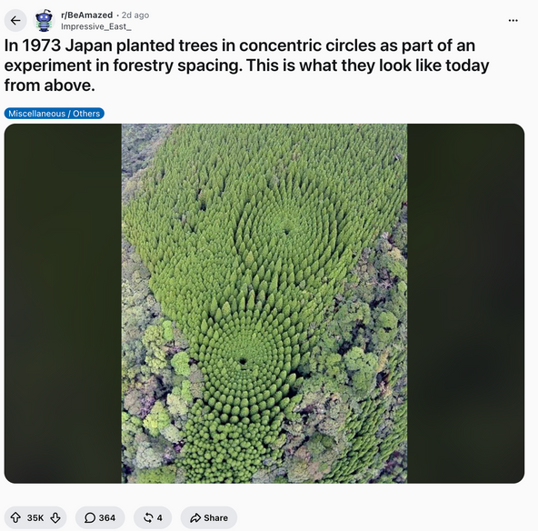
That image and other photographs showing the same formations have circulated online for years, appearing on platforms such as Instagram, 9GAG, Facebook, Pinterest and X.
In short, the photograph was real, and the claim about the forest was also accurate. It showed two experimental plots of Japanese cedar near Nichinan, a city in Miyazaki Prefecture on the island of Kyushu. According to the Miyazaki Southern Forest Management Office, the experiment was established in fiscal year 1973 to study how different planting densities affected tree growth and wood quality. As such, we have rated this claim as true.
The photograph circulating in 2026 was not new — we traced it to at least December 2018.
The same forest has attracted attention before. We previously investigated similar photographs of the experimental plots in September 2024. One of the images circulating at the time was also available in The Associated Press' image archive.
Origin of the photograph
The photograph first gained attention when Japanese news outlet Sankei News published it in a story about the forest.
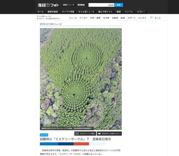
The outlet credited the image to Miyazaki Southern Forest Management Office, a regional office of Japan's Forestry Agency. Its caption (translated from Japanese via Google Translate) read, "A circular pattern visible in the mountains of Nichinan City, Miyazaki Prefecture."
The image later appeared in numerous social media posts and articles.
What the photograph shows
The photographs circulating online show Japanese cedar trees arranged in two groups of concentric circles in a national forest near Nichinan, in Miyazaki Prefecture. An AP caption describing the forest said the trees in the outer ring were approximately 20 meters (66 feet) tall, about 5 meters (16 feet) taller than those near the center.
The circular forest was also discoverable on Google Maps and Google Earth, as the Miyazaki Southern Forest Management Office gave its location as 31°43'50.0"N, 131°23'05.0"E.
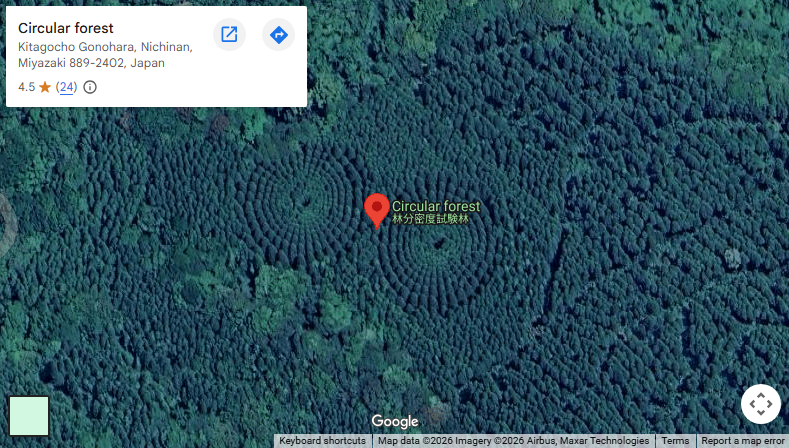
According to the office, the experiment was linked to changes in the local timber industry. Obi cedar was planted sparsely in the area for shipbuilding timber, but demand later shifted toward wood for general construction.
Researchers created the experiment to study how different planting densities affected tree growth and wood quality. It was established in fiscal 1973, with the cedar seedlings planted in March 1974. The trees were arranged in concentric circles at different distances from one another, creating planting densities of about 377 to 10,027 trees per hectare. Seen from above, this produced the circular pattern that earned the site the nickname "mystery circles."
Later surveys showed that planting density affected the trees' size and growth. A 2011 study concluded that around 2,000 to 2,800 trees per hectare was suitable for lower-cost forestry. The experiment's final report, completed in fiscal year 2023, concluded that planting densities of 1,500 trees per hectare or fewer could be effective in terms of financial returns and afforestation costs.
For further reading, in January 2015 we investigated whether a law in Japan makes it illegal for citizens to be fat.