Armenian Prime Minister Nikol Pashinyan, in his speech at the National Assembly, also referred to the government’s mistakes in 2021, mentioning as such the invasion of Azerbaijani units on May 12, 2021 on the sovereign territory of the Republic of Armenia, on the Sotk-Khoznavar section. Pashinyan called this a blunder of the Armed Forces and the government of Armenia, but added that the way the Collective Security Treaty Organization reacted to all this is a blunder of this organization as well.
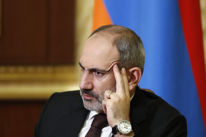
“What happened on the Sotk-Khoznavar section is, of course, a mistake of the Armed Forces and the government. But the way the Collective Security Treaty Organization reacted to what happened, I think, was also a mistake of the organization. Contrary to existing procedures, the CSTO has not yet made a decision to monitor the issue, justifying the long-standing fears of the Armenian public that the organization, which is crucial for the security system of Armenia, will do nothing at the right time and remain only an observer. The fact is that so far the CSTO has not considered this situation in any way, even as an observer.
The Armed Forces of Azerbaijan continue to remain in the Sotk-Khoznavar section, creating a real threat to the security of the Republic of Armenia. But I also want to state that the 45 square kilometers occupied as a result of these events, unfortunately, are not the only ones in the Republic of Armenia. Since the early 1990s, another 70 square kilometers have been in this status, and, as I said, our policy is to consider the issue in the context of the Delimitation and Demarcation Commission,” Pashinyan concluded.
Faktyoxla Lab. has tried to figure out how plausible these statements of the Armenian prime minister are.
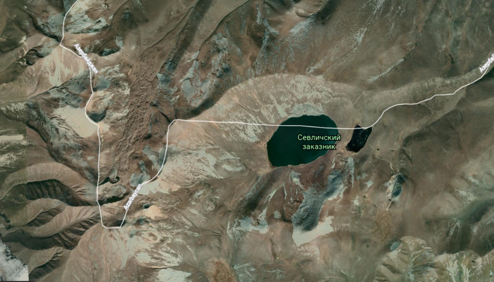
Let's start with what Pashinyan says, most likely, about the entry on May 12, 2021 of a group of servicemen of the Azerbaijani Armed Forces into the territory near Lake Garagol (Sevlich - Armenian) on the border of the Lachin region of Azerbaijan and the Goris region of Armenia. Since then, the Armenian media, politicians, and the Armenian authorities have been accusing Azerbaijan of border violations and military intervention.
On this occasion, the Azerbaijani Foreign Ministry issued a statement that time, explaining that the Azerbaijani border guards only took up positions on their side of the border, as evidenced by Soviet maps, including the Topographic map of the region, published in the 70s of the last century for the General Staff of the USSR Armed Forces. The statement clarifies that this was done in the process of the current clarification of the border.
So how justified in that situation is Armenia’s appeal to the CSTO from the point of view of the internal regulations of the organization?
Article 8 of the Charter of the Collective Security Treaty Organization reads, inter alia, as follows:
Member States shall take measures to establish and operate within the Organization a system for responding to crises that threaten the security, stability, territorial integrity and sovereignty of Member States.
The Member States cooperate in the areas of protecting state borders, exchanging information, information security, protecting the population and territories from natural and man-made emergencies, as well as from dangers arising from or as a result of military operations.
The document does not specify the critical criteria for determining the formal reasons for the outbreak of hostilities. What, for example, should be considered a threat to security, territorial integrity and sovereignty? Can a military group cross the state border, the process of clarifying which has not yet been completed?
That is, in the Charter, the “casus belli” for military intervention of the Organization for the Protection of the Member States is defined without specifics, which involves the interpretation of situations and the adoption of decisions, including political ones, on an individual basis.

Article 3 of the Charter notes that the goals of the Organization are the strengthening of peace, international and regional security and stability, the protection on a collective basis of the independence, territorial integrity and sovereignty of the member states, in achieving which the member states give priority to political means.

Article 4 of the Collective Security Treaty says that if one of the participating States is subjected to aggression (an armed attack threatening security, stability, territorial integrity and sovereignty), this will be considered by the participating States as aggression (an armed attack threatening security, stability, territorial integrity and sovereignty) for all states - parties to this Treaty.
As is seen, the tasks and powers of the organization are specifically defined. The participating countries can provide military support only if the territory of one of them is under armed attack. However, not a single fact of the military intervention of the Azerbaijani side on the territory of Armenia has been recorded. Simply put, the Armenian side, after the trilateral statement of November 10, tried to present the ongoing border demarcation as a military intervention.
After the November 10 statement signed following the Second Karabakh War, the process of clarifying the border between Azerbaijan and Armenia started. In some districts of Kalbajar, Zangilan, Gubadli, the border has already been delimited.
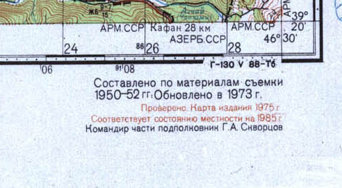
The process is carried out on the basis of topographic maps of the former USSR, in particular, maps of the General Staff of the Armed Forces of the USSR published in the 1970s, including GPS coordinates.

The topographic map of the 1970s clearly shows that part of Garagol belongs to Azerbaijan. GPS data confirms this.

From this it becomes clear that the Azerbaijani armed forces are deployed not on the territory of Armenia, but on their border positions in the Lachin region, located by the lake.
From the information posted on the website of the Ministry of Ecology and Natural Resources, it becomes clear that the lake is located on the territory of the Garagol State Natural Reserve, created on October 17, 1987 by the decision of the decision-making bodies of the Azerbaijan and Armenian SSR, and the lake was declared inter-republican.
Before the occupation of the Lachin region by the armed formations of Armenia (the date of the occupation of the Lachin region - May 18, 1992), the heights around Garagol were under the control of the Armed Forces of Azerbaijan.
This is not the first protest of the government bodies, politicians of Armenia within the process of clarifying the borders. Earlier, during the clarification of the Kalbajar and Gubadli districts, it was also stated that some territories belonging to Armenia were "passing" under the control of Azerbaijan.
Now let’s move to the "Sotk-Khoznavar section" that Pashinyan is talking about. The Armenians argued that the Zod gold deposit in Kalbajar belongs to Armenia. However, official documents indicate that at least 74% of the field falls on the territory of Azerbaijan. This was also recognized by Prime Minister of Armenia Nikol Pashinyan.

Pashinyan stated that the delimitation doesn’t violate the law "On the administrative-territorial division of Armenia", adopted in 2010. The border of the territory on which the gold deposit is located is also clarified, as described in this law.
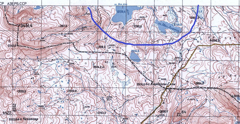
Some Armenian politicians reported that the Boyuk and Kichik Alagol lakes in Kalbajar were being torn away from Armenia, but on the maps to which the Armenians refer, it is clearly visible that these lakes are located on the territory of Azerbaijan.
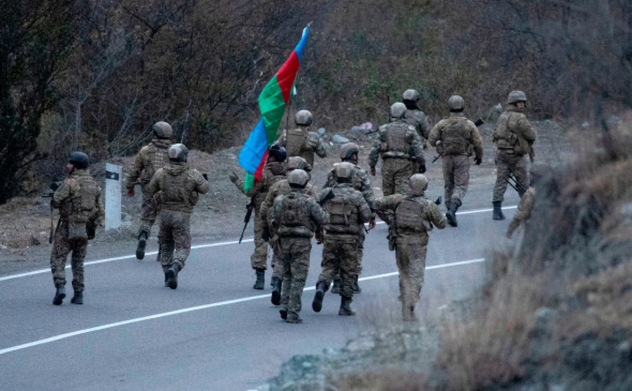
Armenian government structures, politicians, and the Armenian media asserted that the 66-kilometer Goris-Kapan road also fully belongs to Armenia.
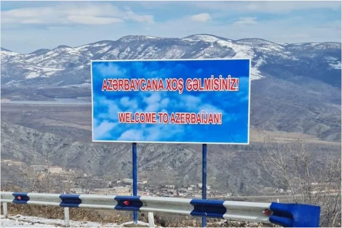
Placing the Azerbaijani flag, a board with the inscription "Welcome to Azerbaijan" on the specified road was regarded as an intervention in the territory of Armenia. However, on the map left over from Soviet times, one can see that part of the road passes through the territory of Azerbaijan, namely through the village of Eyvazli, Gubadli region, the outskirts of Bazarchay, and then turns to the village of Voratan in the Goris region of Armenia.

As the map shows, a section of the Goris-Kapan road on the Vorotan (formerly Shahverddiler) - Davitbek section with a length of 21 km (formerly Zeyve) passes through the territory of Azerbaijan near the villages of Eyvazli and Shurnukh of the Gubadli region.
In addition, Minister of Territorial Administration and Infrastructure of Armenia Suren Papikyan admitted that part of the Goris-Kapan road passes through the territory of Azerbaijan. He noted that in Soviet times the road was laid like this, but its passage through the territory of the two union republics didn’t create problems. Papikyan stressed that five sections of the Goris-Kapan road enter the territory of Azerbaijan and then turn back to Armenia again.
The listed facts indicate that Azerbaijan, contrary to the statements of Pashinyan, didn’t invade the territory of Armenia.


